displaying 1 - 2 records in total 2
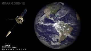
10 Years of Weather History in 3 Minutes
- Published_at:2013-08-19
- Category:Science & Technology
- Channel:NOAAVisualizations
- Ranked in:

- tags:
- description: NOAA's GOES-12 satellite was decommissioned on August 16th, 2013 after 3,788 days in service. From April 2003 -- May 2010, GOES-12 served as GOES East, providing "eye in the sky" monitoring for such memorable events as the 2005 Atlantic hurricane...
- Video details

High Speed Satellite Imagery of Hurricane Sandy
- Published_at:2012-10-29
- Category:Science & Technology
- Channel:NOAAVisualizations
- Ranked in:


- tags:
- description: As the NOAA GOES-13 satellite provides on-going operational coverage of Hurricane Sandy, a special Super Rapid Scan Operations (SRSO) has been scheduled for GOES-14, NOAA's backup geostationary weather satellite. Focusing just on the area of the...
- Video details
displaying 1 - 2 records in total 2